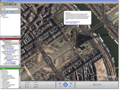
Google Earth is a 11.2 MB download - go to the Google home page and click on more >> or just click here. Once you download the installation program click on the file to start the installation and follow the instructions. Once installed it will place a Google Earth icon on your desktop from where you can launch the application.
The program is based on satellite imagery and was devised by tech startup Keyhole, which was purchased by Google after their IPO. What the program allows you to do is zoom seamlessly from a whole-earth view right down to street level where people, allbeit as small dots, can be seen. While all the world is mapped, not all of it is mapped to the same resolution. For example, for Dublin, south of the Sugar Loaf and west of the M50 are not shown in great detail. However,
 Google are updating their maps continually and our own house was low resolution up until 3 months ago - now I can tell that there was no one on our chimney the day the picture was taken!
As a piece of software, Google Earth is more interesting than useful. It's a bit like browsing through an encyclopedia - you keep going to new subjects just because you're curious to find out about them rather than having a pressing need for the information. But who ever said great software has to be useful. Try it - I guarantee you'll enjoy the experience of being a voyeur from 12,000 feet.
No comments:
Post a Comment